Santorini is a cluster of Cycladic islands, in Greece. It is the most active centre of the South Aegean Volcanic Arc, a location of high natural and cultural significance. The impressive caldera and the volcano echo of the island’s progress, history and cultural heritage, integrally linked to the forces of nature. Santorini is known for its spectacular natural beauty, outstanding archaeological and architectural landmarks, interesting museums, dramatic landscapes, exquisite views, and a magical aura, all of which attract millions of visitors every year. In 2018 Santorini was included in the National Index of Intangible Cultural Heritage (ARK) as a Protected Designation of Origin (PDO) wine region.
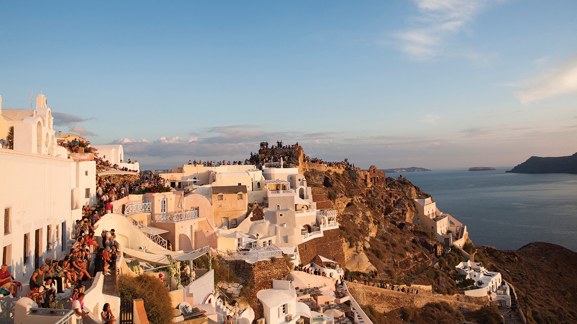
Santorini view
The island of Thera (modern Santorini) owes its creation to the volcanic activity that evidently began in its region about 1.5 million years ago. Pre-existed islets of semi-crystalline limestones or phyllites and materials of successive eruptions, were gradually fused into a single island. When it was first inhabited, the island owed its shape to a major eruption that had taken place about 22,000 years earlier.
The first human presence on this island, with a water-filled caldera, is testified as early as the mid-5th millennium BC (Late Neolithic Period, 5300-3200BC). Since then, and until the enormous volcanic eruption around 1600 BC, which fragmented the island to the present-day cluster of Thera, Therasia and Aspronisi, the island has constantly been inhabited.
Lying at an important geographical position in the network of the Aegean islands, the island played a dynamic role in shaping the Cycladic Culture. Its creative course during the Bronze Age (from 3200BC until the 1600 BC volcano eruption) is testified by archaeological evidence at several sites of Thera and Therasia and, mainly, in the prehistoric city at Akrotiri, one of the largest and most important urban centres and ports of the Aegean Sea during the 18th and 17th centuries BC.

Archaeological evidence in Santorini
The colonisation of the island of Thera by Dorian settlers, during the Geometric period (according to archaeological evidence in the 8th c. BC), seems to signal the beginning of its uninterrupted re-inhabitation to date, after the eruption around 1600 BC. The island was named Thera by the leader of the settlers, and throughout Antiquity, the homonymous city, founded on Mesa Vouno [Inner Mount], was the urban, administrative, commercial and religious centre of the city-state of Thera. Apart from the city and its two seaports, at the contemporary settlements of Kamari (ancient Oia) and Perissa (ancient Eleusis), several settlements and smaller installations, evidently agricultural, developed on the island at various places, as early as the Archaic period, during which the city-state of Thera flourished.
The earliest datable event concerning the city-state of Thera was sending selected Theran settlers to Libya, where they founded the city of Cyrene in 631 BC. At the outbreak of the Peloponnesian War, in 431/0 BC, Thera was forced to join the First Athenian League. After the defeat of the Athenians in 404 BC, the island passed into Sparta’s sphere of influence, and later became a member of the Second Athenian League, founded in 376/5 BC, a member of which it must have remained until the Battle of Chaeronia in 338 BC, along with the other islands of the Archipelago of Cyclades. After 288 BC, Thera came into the sphere of influence of the Ptolemies, rulers of the Hellenistic Kingdom of Egypt, who finally organised the island as a Ptolemaic possession. After the end of the Ptolemaic period in 145 BC, during which the island flourished, Thera was probably independent for more than a century.
Roman influence is evident as early as the 1st c. AD. While the Roman navy still effectively controlled the Aegean, the city-state of Thera, as part of the Roman Province of Asia, enjoyed its last period of prosperity. From the middle of the 3rd century, the uncertainties brought about by foreign incursions in many parts of the Greek world led to the island decline. Thereafter, with the administrative reforms of Diocletian, it became part of the Roman Province of the Islands.
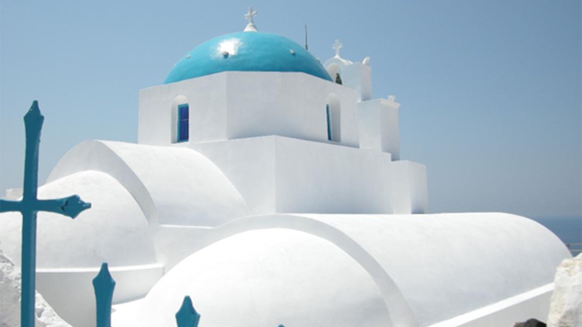
Church in Santorini
The people of Thera embraced Christianity early. As an episcopal seat, the island took part in the Sixth Ecumenical Council with Bishop George, at the end of the 7th c. The main island settlements of the period can be found in Mesa Vouno (ancient Thera) and its seaports. In these sites, besides residences, roads, and cemeteries, there are also characteristic monuments of early Byzantine basilicas, the most important one being that of St. Irene in Perissa, built in the 6th c. During the turbulent 7th c. Avar-Slavic and Arab invasions disrupted the island.
Three chroniclers, Theophanes the Confessor (9th c.), Nicephorus I Patriarch of Constantinople (9th c.) and George Kedrinos (11th c), mention a major volcanic eruption that took place in 726. The eruption was related to the Iconoclasm movement, which caused the Cycladic revolutionary movement in 727.
During the 8th c. the inhabitants of the seaports moved to the safer location of Mesa Vouno. Little is known about this period. Thera was part of the Theme of the Cibyrrhaeots (Thema Kibyrrhaiotōn) of the Byzantine Empire, which encompassed the southern shores of Asia Minor and the Aegean islands. The most important monument of Byzantine Thera is the Katholikon of the Panagia Episkopi Monastery, built at the end of the 11th c. or, according to other scholars, at the end of 12th c.
Thera appears in the Muslim geographer al-Idrisi, as "Santurin" in the 12th c., as named after the island's patron saint, Saint Irene. During the Fourth Crusade, the Duke of Naxos, Marco Sanudo, appointed Jacob I Barozzi as the Baron of Santorini in the beginning of the 13th c. For a short time (1278 -1302) Santorini came once again under Byzantine Emperor Michael VIII Palaiologos. In 1335 it was annexed by the Duchy of Naxos, under Niccolo Sanudo, who gave the island to the Gozzadini family. Santorini was also ruled by the Crispi and the Pisani families. During the Venetian period, five fortified settlements known as “Kastelia” defended the island. In 1566 Sultan Selim ΙΙ granted the island to the Spanish-Jewish favourite, Joseph Nasi. The island was conquered by the Ottoman admiral Piyale Pasha in 1576, after suffering numerous Ottoman raids.
During the 18th c., following The Treaty of Kuchuk-Kainarji, political and economic conditions, favoured the economic growth of Santorini. During the Russo-Turkish War of 1768–1774, the island came under Russian rule for a very short period of time and then returned to its former rulers.
In May 1821, the island participated in the Greek Liberation War and became part of the first Greek state in 1832. A period of flourishing shipping trade and exports of goods (cotton, textiles, agricultural products, wine) ensued; the economy declined due to the wars of the 20th century. In 1956, a few years after the volcanic eruption of 1950, a catastrophic earthquake hit the island, causing incalculable damage. Although its reconstruction started immediately, only after the 1970s, with the gradual growth of the tourism industry, supported by a new harbour and an airport, did the island finally recover financially. Today, Santorini, officially Thera, well known for its volcano and Caldera, its antiquities, traditional villages and wines, is one of the most famous tourist destinations in the world.
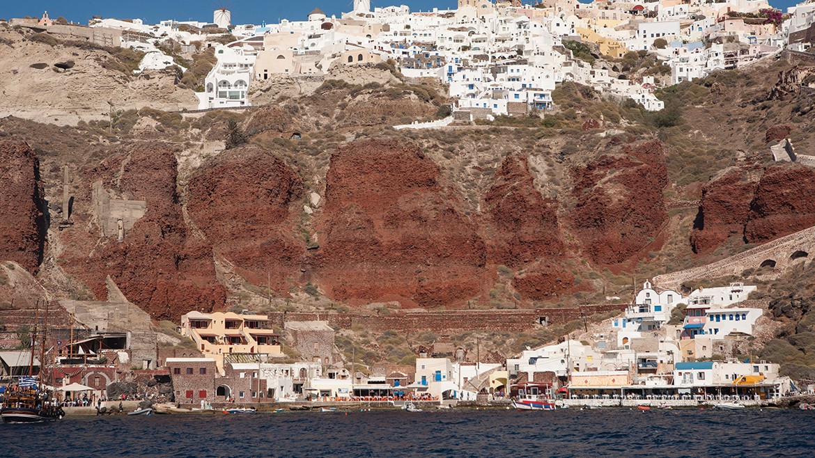
Ammoudi Bay, Oia's fishing harbour
The landscape of the volcanic island cluster of Thera, a unique monument of nature that attracts global interest, is sculptured with man’s works created over time. Settlements and several sites of prehistoric and ancient times, castles of the Byzantine and post-Byzantine periods, as well as stand-alone monuments, mostly churches of the post-Byzantine and late post-Byzantine times, scattered throughout the perimeter of the Caldera, make up a network of archaeological sites and monuments spanning all periods of human presence on the island cluster, from the Late Neolithic Period to present-day traditional settlements.
The natural volcanic environment of the Caldera, on the cliff and walls of which monuments have been erected over time, inevitably determines the specific treatment and protection such monuments require. Erosion and its accompanying effects on the landscape are clearly apparent. Because the remarkably high, steep, inner walls of the Caldera are made of pyroclastic material, which is often very unstable, landslides, a particularly serious danger when earthquakes loosen the rocks, are a common occurrence.
Prehistoric settlement and late post-Byzantine churches at Megalochori
Due to the activity of a modern, now inoperative mine of pozolana -named after the island of Thera as «Theraic earth»- in the district of Megalochori, the remains of a settlement was brought to light under the thick ash-layers of the Late Bronze Age volcanic eruption. The excavation revealed parts of building remains along with several artefacts, documenting that the settlement was founded in the Middle Bronze Age and abandoned in the early Late Cycladic I period, when a serious earthquake struck the island. The settlement bears witness to the fact that the cliff-edge of the Caldera was inhabited in prehistoric times.
Today’s landscape in this part of Caldera, inevitably stigmatised by the activity of the expanded mine, now a silent witness of the economic activity developed on Thera in the 20th century, is complemented by the Late post-Byzantine churches of St. Paraskevi and St. Demetrius standing today on the edges of the mine.
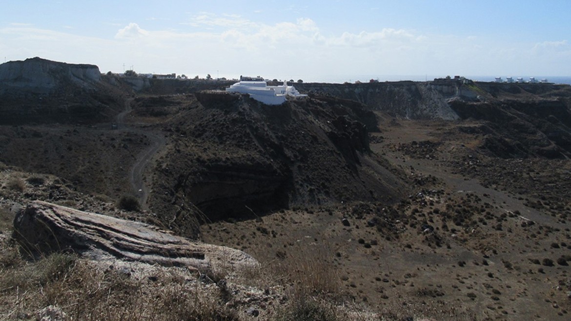
Mines of Megalochori - Post-byzantine churches
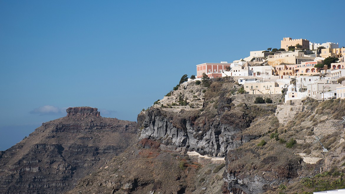
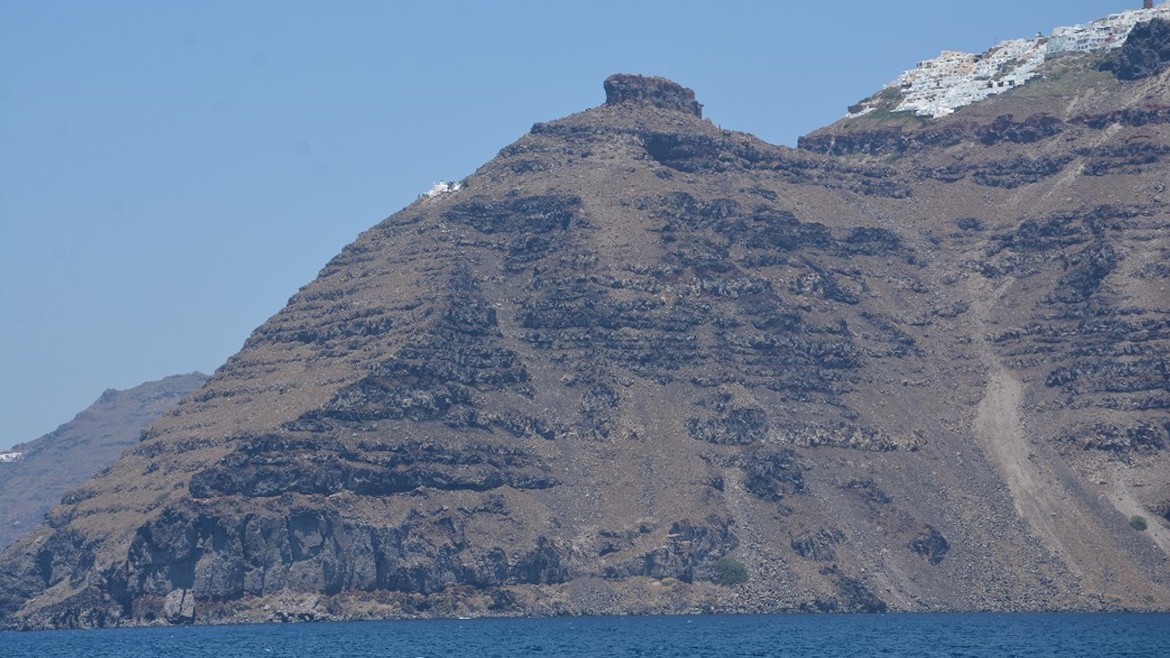
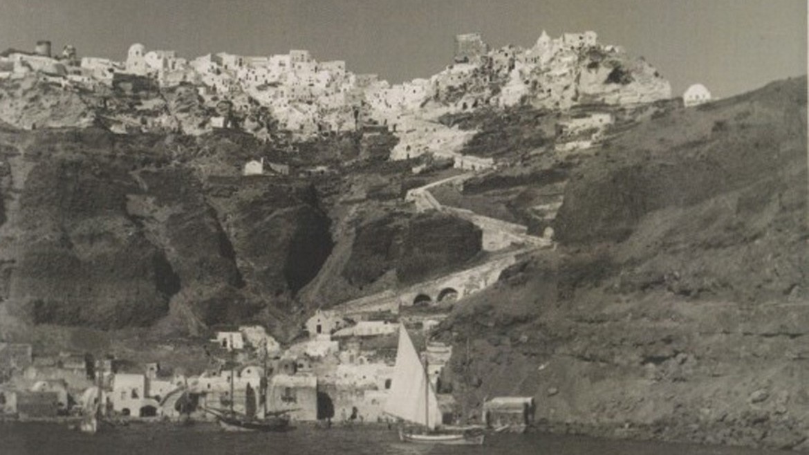
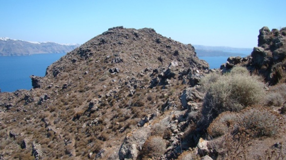
The promontory and the Castle of Skaros
The rocky plateau, now deeply fractured and eroded, at the top of Skaros promontory, at an altitude of nearly 300 meters and its steep slopes, constitute both a characteristic landmark on the western coast of Thera and a site that has been continuously inhabited. The promontory was shaken repeatedly by strong earthquakes during the serious eruptions of 1650, 1707-1711 and 1866-1870.
Skaros
Skaros northeast view
An inscription, engraved on the cliff and dating approximately to the second half of the 5th century BC, marked the boundary of a sanctuary dedicated to Athena. The inscription, in addition to several reports concerning other antiquities, suggests the existence of a settlement at Skaros promontory in antiquity.
The Castle of Skaros, built on this naturally fortified location in 13th century by the Barrocci family, which ruled the island from 1207 until 1265, was the first Venetian capital of Thera. Its name “Scharo” first appears in 1485, in the map by traveller Bartolomeo da li Sonetti. The densely populated settlement, with its apparent fortified character, is constructed at two levels, namely, the Upper Castle or "Roka", and the Lower Castle, at the foot of the rock.
Although the Castle of Skaros was the headquarters of the Catholic Bishop, within the fortress there were monasteries and churches established by both Catholic and Orthodox doctrine worshippers. Today, the ruins of the churches of St. Eirini and of Panagia of Maroula can be seen in front of the missing Castle gate. The church of Panagia Theoskepasti is still standing on the west slope of the hill.
Roka must have been abandoned in the 17th century; during the 18th-early 19th c. period, the population also abandoned the Lower Castle and moved to Fira.
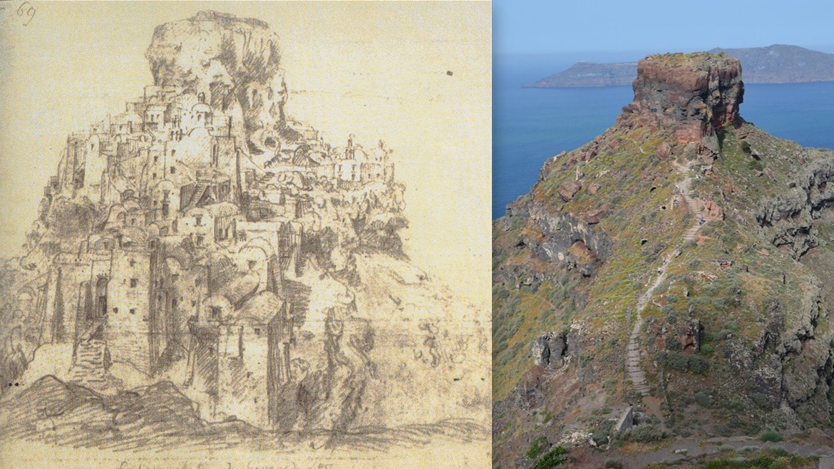
Skaros, Thomas Hope Collection (1769-1831) / Skaros west view
The Castle of Εpano Meria (Oia)
The Castle of St. Nikolaοs, one of the five Castles that protected the island during the first period of the Frankish rule (13th/14th/century), was built on the north-western side of the island, called Epano Meria or Epanomerea. The Castle situated in this area, first recorded in 1480 and named after St. Nikolaos church, was ruled by the D’ Argenta family, descended from the Byzantine Emperor Romanos Argyros. One of the best fortified castles on the island, it protected three ports used as trading stations. The Castle of St. Nikolaos appears in travellers’ maps, as early as the 15th century. The engraving of 1782 by Choiseul–Gouffier depicts the fortification core of the settlement, consisting of three-storey tall and four-storey tall buildings, with a few openings in their highest parts. At the entrance of the Castle there was a defensive tower, the so called Goula, echoing the Turkish term “Kule” for tower; until the catastrophic earthquake of 1956, the tower had survived to remarkable height. Near Goula there is the ruined church of Panagia Platsani, which was built after 1800.
Castle of Epanomeria
The millennia-long site of Koimisi
At the southernmost end of Therasia, where the Monastery of the Dormition of the Virgin (Koimisi) stands, there are the remains of a prehistoric settlement facing the caldera to the east and Aspronisi to the south; a part of the settlement has collapsed, as a result of the great “Minoan” volcanic eruption. Excavations carried out at the site, since 2013, have revealed a densely constructed settlement, which enjoyed a long period of habitation from the Early Cycladic II period to the end of the Middle Cycladic period.
The surface pottery found in the area documents that the site was also occupied throughout the ancient times, probably from the 8th c. B.C. until the late Roman/Early Byzantine period.
The post-Byzantine monastery of Koimisis, one of the oldest monuments in Therasia, appears on a map drawn in 1745 by the Russian monk Barkji. The Catholicon is a three-aisled barrel-vaulted basilica with a dome and three semi-circular apses. An inscription on a door lintel of a cell that in 1813 the monastery had already been completed. The wooden iconostasis that adorns the catholicon, dates back to 1851.
Katholiko of Koimisi
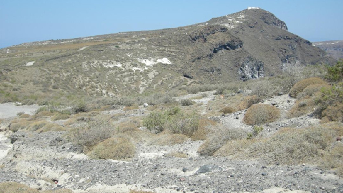
Τhe hill of Prophetes Elias: ancient inhabitants and late post-Byzantine church
The hill of Prophet Elias, the highest hill of Therasia (295m.), is located on the rim of the Caldera, at the central part of the island, south of the village of Manola. On the summit of the hill remains of ancient buildings are still visible. Undoubtedly, these remains, which probably belong to different periods, document, along with the pottery sherds found in the area, that the hill was inhabited in antiquity and that there was a settlement arranged in successive stepped terraces. In addition, a large amount of pottery sherds, scattered in the north and west sides of the hill, document a cemetary of different historical periods, associated with the settlement. Although the site remains unexcavated, existing evidence suggests that the settlement, probably founded at the end of the Geometric period (i.e. in the 8th c. BC) and inhabited throughout antiquity, was the main residential centre of the island of Therasia in ancient times.
Today, the summit of the hill is occupied by the late post-Byzantine monastery of Prophet Elias. The Church, a single-nave basilica with a cruciform vault, can be dated prior to 1745, since it is included in the map drawn by the Russian monk Barkji in that year.
Site of Phophetes Elias
The Byzantine Castle of Therasia at Paleokastro
The Byzantine settlement of Kastro or Paleokastro is located at the northeast of the island. The settlement is built on a low, particularly steep, rocky and naturally fortified hill, accessible only from the west side. The location is a true strategic hub, as it has direct visual contact with the castles of St. Nikolaos in Oia and Skaros in Fira. At the top of the hill there are preserved walls of a barrel-vaulted cisterna. To the south of the cisterna, architectural remains of buildings are preserved, while part of the settlement has precipitated into the east caldera. Pottery sherds helped date the settlement from the 7th to the 11th century. The settlement can most probably be identified as the fort as once depicted on the map drawn by Marco Boschini in 1654.
Paleokastro
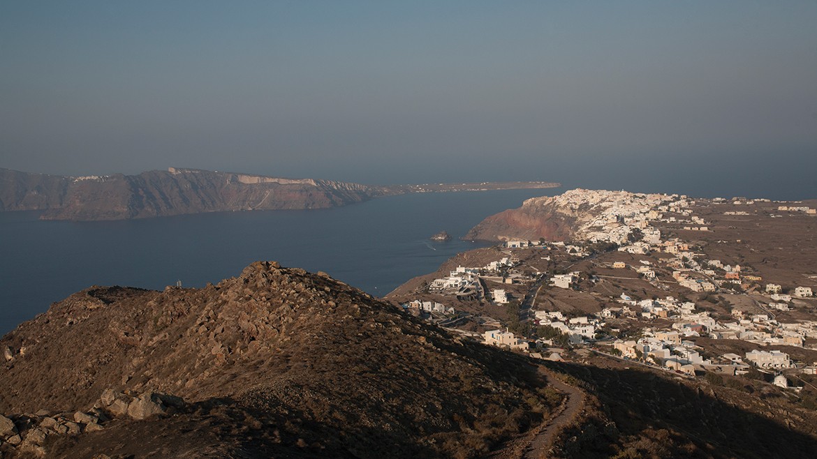
The island cluster of Thera in the South Aegean, a distinctive location, where nature, within one of the most explosive volcanic arcs in the world, plays a leading role, owes its present-day formation to the last caldera-forming eruption of the Late Bronze Age (around 1600 BC), one of the largest eruptions known to mankind in the last 10,000 years. The islands of Thera, better known today as Santorini, a name given to it by Frank Crusaders, and Therasia, as well as the islet of Aspronisi, form a huge water-filled Caldera, a marine basin extending over a surface area of 845 km2, inter-connected with open-sea channels. The Kamenes islets (Palaia Kameni and Nea Kameni) resulted from volcanic activity after the Late Bronze Age eruption.
Volcanic terrain of Santorini
This volcanic terrain is characterised by highly heterogenous flora in the five island cluster. There are no trees growing naturally in Santorini, due to the volcanic activity, the nitrogen-poor subsoil and the low rainfall. Thera is extensively cultivated (80% of the island surface). There are plenty of olive trees and vineyards growing on spacious pumice terraces. Only small areas are used for the cultivation of fruits and vegetables for local use. The fauna of Santorini comprises mainly homebred and domestic animals. There are also hundreds of species of birds observed on the island of Thera, making the region a significant destination for ornithologists.
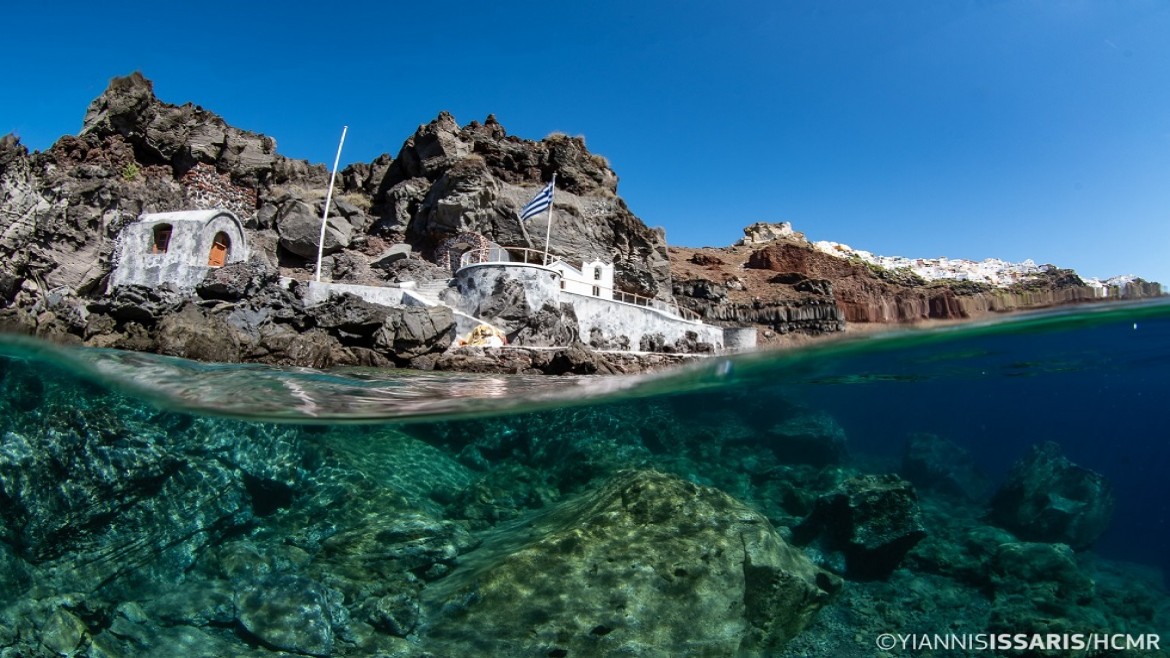
Santorini’s underwater landscape is characterised by caves, dramatic cliffs, incredible clarity and extensive Posidonia oceanica seagrass meadows. This rich native biodiversity is endangered in our days, due to increasing anthropogenic and climate change impacts. Overexploitation of resources, unregulated and chaotic growth, massive tourism, untreated waste disposal and overuse of plastics threaten the ecological integrity of this famous volcanic Aegean island. Urgent action, joint efforts and the designation of strictly protected areas can establish prerequisites for sound environmental management to ensure a sustainable future.
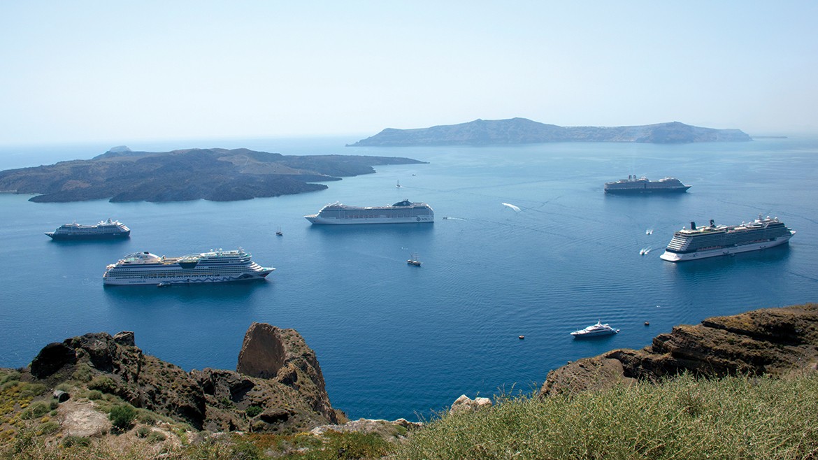
Tourism in Santorini
The crescent-shaped Cycladic island of Santorini, core of a cluster, where belong another four islets is a uniquely beautiful remnant of a violent volcanic past with a series of cataclysmic explosions that stigmatised the natural and cultural heritage of the island and the life of its inhabitants. In nowadays is one of the most awesome Mediterranean settings and irresistible tourist destinations. Santorini participates in the MoNa Project with the aim of taking initiatives concerning the environmental-cultural management and the sustainability of the island given the increasing tourism industry of the region. A series of activities and workshops will take place:
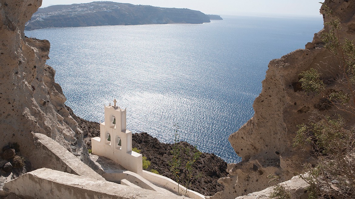
Oia, Church of Agios Nikolaos o Peramataris